
views
Getting a Quality Education

Earn good grades in high school. If you know as early as your high school years that surveying is the profession you wish to enter, you should work hard to earn good grades. You will likely need a college degree, so doing well in school will help you gain access to the college or university of your choice. You should begin to focus on math and science courses, as these will be most directly related to your future work. A strong background in reading, writing and analysis will also be helpful.

Earn a degree from a reputable college or university. To get a job as a surveyor, you will need a college degree. In some cases, you may be able to get what you need with a two-year associate’s degree, although a four-year bachelor’s degree would be preferred when looking for work. A good program is one that will include in-depth study in advanced math, technical drafting, writing, physics, and technically advanced computer program use. The guidance counselor at your high school should be able to help you research colleges and universities that have strong programs that can lead to a career as a surveyor. If you are already out of high school, you may try calling the guidance office of the high school in your area to see if they could help you anyway. You might also check with the reference librarian at your public library or at an area college library. For licensing purposes, some states require that your degree come from a school or program that is accredited by the Accreditation Board for Engineering and Technology (ABET). Before you apply to any school, you should ask an admissions officer if they have this accreditation.

Select a field of study. The general category of surveying involves many smaller categories, which you may wish to choose as a specialty for your studies in college. You will want to research these topics before enrolling in a college or university program, so you can best tailor your studies. Some of the topics related to surveying include: Geomatics. This is a fairly new science that includes the collection, interpretation and reporting of geographical data. Geodesy is the science of geographical measurement and representation. It measures such things as the gravitational fields of the earth, tectonic plate movements, polar ice shifts, and tidal phenomena. Photogrammetry is the science of acquiring geographical data from photographs and photo images. This field includes studies in aerial photogrammetry and close-range photogrammetry. Land management is the study of the way land is used, to best take advantage of its geological structures.
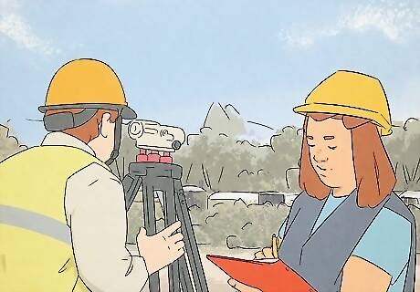
Participate in a quality internship. Many university programs will help you get involved in an internship as part of your program while you are attending classes. An internship is a placement with an actual surveyor, so you can learn real, on-the-job techniques and business practices, in addition to your classroom education. If you do well in your internship, it can also lead to full-time employment beyond your college degree. Many states may require that you spend time in an internship under a licensed surveyor before you are even eligible to sit for the licensing exam.
Passing the Licensing Examination

Become familiar with the Fundamentals of Surveying (FS) Exam. Throughout most of the United States, the Fundamentals of Surveying (FS) exam is required to become licensed as a surveyor. This exam is usually offered in April and October. The exam is scheduled to last approximately 6 hours and consists of questions covering general topics like algebra, trigonometry, other basic sciences and writing skills. It also includes questions on such specific topics as boundary law, field data acquisition and plane survey calculation. Most of this information should be covered during your course of study in your college or university.

Prepare for the FS exam. In most cases, your college study should prepare you for the FS exam. Many people elect to take the exam while nearing the end of their college program, or soon after graduating. If you wish to engage in additional preparation, specifically designed for the exam, there are numerous books, study guides and even courses available to help you prepare. A quick Internet search for “fundamentals of surveying exam” will lead you to all the information you need. In addition to commercial study guides, you can find various free resources online. For example, the publication The American Surveyor has posted an article that contains a summary of the test and sample questions.
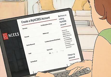
Study the FS Reference Handbook. The NCEES, the professional organization that administers the FS Exam, posts an FS Reference Handbook on its website. To access the Handbook, you must first register an account with NCEES, which you can do online at http://ncees.org/surveying/fs/. The FS Reference Handbook contains all the information you need about the content of the FS Exam and about registering and sitting for the exam. The FS Reference Handbook is the only resource that you are allowed to use as a reference during the exam itself.

Register for the FS Exam. You can register for the FS Exam at the NCEES website at http://ncees.org/surveying/fs/. You will need to create an account, which will be private with a password. You will use this account to register and schedule your exam, as well as for communication between yourself and the NCEES. Registering for the exam includes the payment of a $225 exam fee. You will pay this with a credit card online. Some licensing boards may require an additional application and application fee. You should check with the jurisdiction where you wish to be licensed to determine its requirements.

Pass the FS Exam. When the date arrives for your exam, you should arrive at your testing location early. Take along multiple forms of identification and any registration materials that you have received. Realize that the test lasts for approximately 6 hours, which includes a brief tutorial on the use of the computer and a break for lunch. You will take your test on a computer under proctor supervision. Within seven to ten days after your exam, you will receive an email notification that your scores will be available in your NCEES account. If you are not familiar with the area, you may wish to take your lunch with you for the day, to avoid any anxiety on that issue.
Applying for and Getting Your License
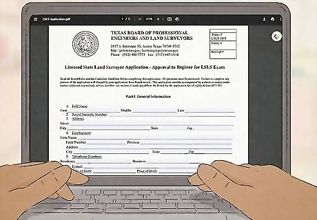
Identify your state’s licensing board. NCEES offers a useful page that provides links to the licensing boards of all 50 states in the U.S. Find your state and then follow the link to the licensing board’s website. From there, you should be able to follow the instructions for information about a license application. For example, the link for Alabama will redirect you to the website of the Alabama Board of Licensure for Professional Engineers and Land Surveyors. From there, you can choose the link for “Applicants” to learn your application requirements. If you wish to get licensed in Texas, for example, the link will take you to the Texas Board of Professional Land Surveying. From there, select the tab “LSLS” to get information about becoming a Licensed State Land Surveyor.
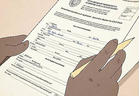
Obtain and complete a license application. When you find your state’s licensing board’s website, look for a link to “Application” or “Application Process.” You will need to print the application form, complete it, and provide whatever application fee is required. This fee is in addition to the exam fee that you were previously required to pay for the FS Exam. Read the website carefully to find out if any additional materials are required. For example, if you are applying for licensure in Texas, you are required to provide all of the following materials or information: Completed application form. Application fee of $128.69. 3 Completed References. These are to be provided using the state’s official form, which is available on the website. The references are to be in individually sealed envelopes with the seal of the referring party on the back of the envelope. At least one of your references should come from a licensed surveyor. A working sketch. You are to prepare a working sketch of a location of your choosing. Instructions for the sketch are reported on the website. An appointment with the Director of Surveying of the General Land Office. This appointment should be made before you create your working sketch.

Take and pass the state license exam, if applicable. Some states will require a state-based exam, either in addition to or in place of the nationwide FS Exam. You should read your state’s license board’s website to find out if such an exam applies to you. If it does, you will need to submit your application materials in time to be able to take that exam. Staying with the Texas example, you will need to submit your application by January 15 in order to take the LSLS exam in April, or by July 15 to take the LSLS exam in October.

Comply with any additional requirements for advanced or professional licensing. In many jurisdictions, the initial license that you will receive is a preliminary or temporary license. This will generally qualify you to work as a surveyor in conjunction with or under the supervision of a professionally licensed surveyor in your state. After some prescribed time, you will qualify to sit for an advanced exam, known nationally as the Professional Surveyor’s Exam (PS Exam). The procedure to register for the PS Exam, which is also administered by NCEES, is similar to the procedure for the FS Exam. You will also need to determine what your state requires for advanced licensing.


Comments
0 comment