
Understanding the Map's Layout
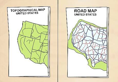
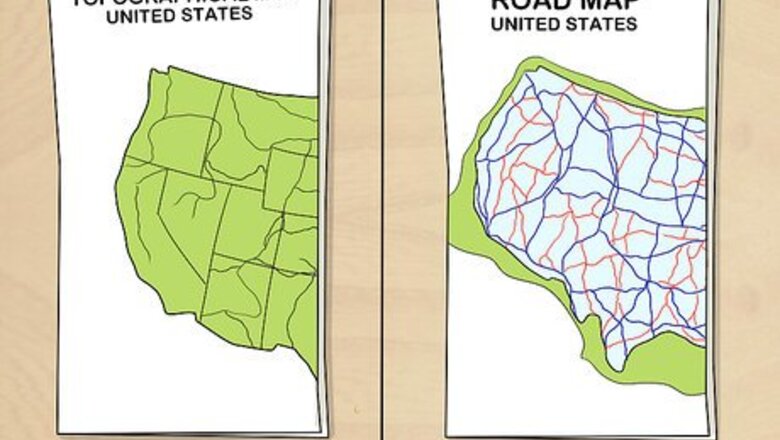
Choose the right type of map. Different kinds of maps exist for different uses. Before you can use a map to help you find your way, you’ll need to make sure you’re equipped with one that’s suitable for the type of traveling you’re doing. For example, there are road maps to help drivers navigate back roads and interstate highways, topographical maps telling campers how to reach campsites and lodging areas, and even tourist maps highlighting famous landmarks for sightseers. Maps can be found just about anywhere, from gas stations and visitor centers to restaurants and popular attractions.
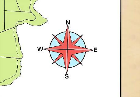
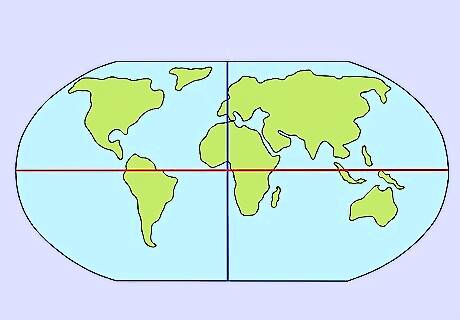
Check the map’s orientation. Open up the map and take a moment to double check that you’re examining it from the correct perspective. Most maps feature a “compass rose” in one corner that shows which directions are indicated by the various markers. Unless otherwise specified, the top of the map will always correspond with North. North is considered a “neutral” orientation which provides a reference for the other directions. It can be used to help travelers get their bearings.
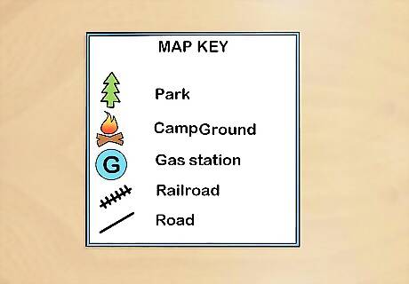
Refer to the legend (also called the Map Key) to make sense of the map. In addition to a compass rose, many maps also contain a legend, or chart that explains the scientific methods used to draw up the map and lists what important symbols mean. Familiarizing yourself with the legend is key to comprehending the way the map displays information. Here you’ll find symbols representing roadways, town and city limits, and prominent landmarks, as well as color-coded environmental features like mountains, forests, and bodies of water. These elements are designed to educate travelers on how to interpret and safely traverse their surroundings.
Make a note of the longitude and latitude. A Meridian of Longitude is a geographic coordinate that specifies the east-west position of a point on the Earth's surface, relative to the Prime Meridian. Meridians of Longitude (these "Long" lines) run vertically from the North Pole to the South Pole (or vice-versa, South to North). Parallels of Latitude run parallel to the Equator (the "waist line" of the globe) horizontally, and show distance north or south of the Equator. The numbers at the sides and top or bottom of the map track the degrees of Longitude and Latitude. Each degree represents 60 "minutes" (which describes fractions of distance, not travel time); 1 degree of latitude represents 60 nautical mile or 111.12 Km (roughly 69 land miles). The Equator and the Prime Meridian were chosen as handy reference points because they’re located roughly in the center of the globe. If you’re just making a trip to the next town over, longitude and latitude won’t come into play. For long-distance journeys, however, they’ll be invaluable for coordinating your positions.
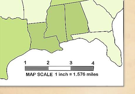
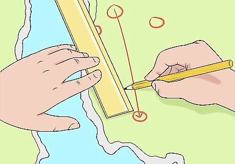
Pay attention to the scale. A map’s scale provides a ratio of map distance to actual distance. This will give you an idea of just how far you have to go. The scale will differ from map to map, but will typically be presented as a number ratio, like “1 : 100,000.” This ratio simply means that 1 unit of distance on the map is equal to 100,000 units in real life. You’ll usually be able to find the scale at the bottom or off to one side of the map. Depending on the type of map you’re using, the scale will be adjusted accordingly. For instance, an explorer map (used for hiking, cycling, kayaking, and similar short-range activities) will have a scale around 1 : 25,000, while the average driving map will be closer to 1 : 50,000. On a roadmap with a scale of 1 : 100,000, for example, 1 inch (2.5 cm) of space on the map will be equal to 1.578 miles (2.540 km).
Using a Map to Get Where You're Going
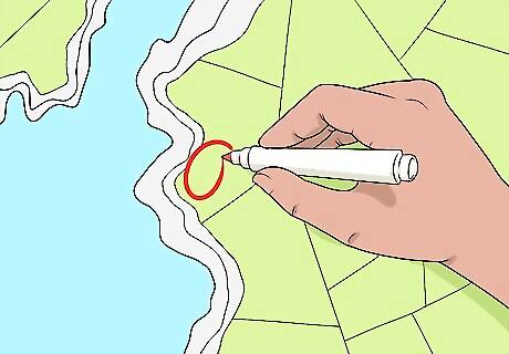
Figure out where you are. If you’re on the road, the simplest way to do this is to observe nearby street signs or highway markers and cross-reference them on the map. If you’re stranded someplace with no way of telling where you are, try to match up what you see in real life with what you see on the map. From there, mark your position so you can get yourself pointed in the right direction. Some common features that can help you identify your location include outstanding natural features, like rivers and mountains. One useful trick for establishing your whereabouts is to start with two landmarks within seeing distance (for example, a water tower and a small town) and draw a straight line between them. The point where they intersect is your rough location, give or take a mile or two.
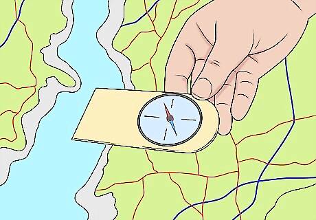
Make sure the map is aligned correctly to your compass (optional). Assuming that you're using a compass to aid in navigation, it will be important to calibrate it so that it's correctly oriented with your immediate surroundings, taking into account possible variations in magnetic attraction (if abnormalities exist, they will ordinarily be noted somewhere on the legend). This step is sometimes known as “declination.” It will be much easier to get a sense of where you’re going when you can simply turn your head. It’s a good idea to keep a compass in your vehicle or gear bag whenever you embark on an expedition where becoming lost is a distinct possibility. Nowadays, most smartphones have compass apps that are remarkably accurate and don’t need to be connected to the internet to function.
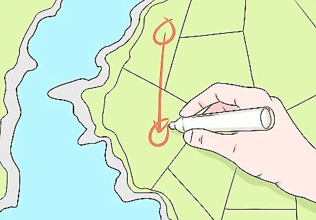
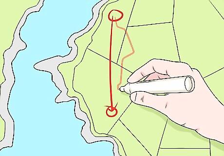
Pinpoint your destination. Circle the place where you want to end up on the map and look at how much distance lies between your start and endpoints. Once you’ve done this, you can zoom in and the identify which avenues will allow you to arrive at your destination in the shortest amount of time possible. Calculating the distance to scale will help you to track your movements more precisely.
Plot your course. From here, it’s simply a matter of choosing which roads or paths you want to take to get from Point A to Point B. Keep in mind that the shortest distance between two points is a straight line. Consequently, it’s usually best to stick to a direct route with a minimal number of branches or detours. Remember, interstate systems are most often laid out left to right and south to north, while city streets are arranged in a grid pattern for more efficient navigation. One shortcoming of traditional maps is that they won’t be able to alert you to road closings, construction work, renamed streets, and other potential obstacles.
Follow the selected route to your destination. Now that all the details have been worked out, you can focus on the journey itself. Roam confidently and watch the miles tick off, glancing back at the map as often as you need. Be careful not to deviate from your course unless you’ve figured out a different route in advance. The exact course you take will largely be a matter of preference—in some cases, you may be pushing it to get to your destination on time, while in others you might be traveling at a leisurely pace and want to make the occasional stop to do some sightseeing. If you’re traveling with someone else, assign the navigating duties to one person so there won’t be any dispute or confusion over how to interpret the map.
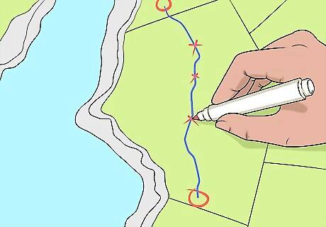
Create checkpoints to keep from losing your way. As you move along, keep track of your progress using a pencil or other writing utensil. Draw a dot, star, or some other symbol whenever you come to a notable landmark. That way, you’ll be able to refer to the last checkpoint you passed should you happen to get turned around. Every time you stop, record how far you’ve come, and work out how much distance you still have ahead of you.


Comments
0 comment