views
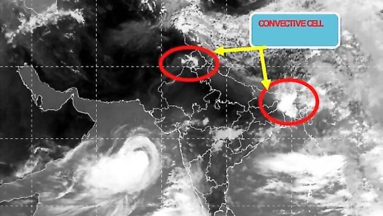
Even as the monsoon progresses slowly over the India, there is cyclonic storm in the Arabian Sea which is picking up intensity. The cyclone named Nanauk is likely affect the southwest monsoon, an India Meteorological Department (IMD) official said.
But the IMD is yet to make it clear if Nanauk will help the monsoon or further delay it. Presently the cyclone is moving towards Oman away from India's west coast. It is picking up intensity and the landfall is expected around June 15.
If the cyclone maintains its current direction away from India, it will have an adverse affect on the monsoon but if it changes its direction and moves towards the Maharashtra and Gujarat coast, then these areas would receive heavy to very heavy rainfall. Such a scenario will also help in the monsoon's progress, which has not been very encouraging till now.
Nanauk is over East Central Arabian Sea and is slowly Northwest wards and lay centred at 8:30 AM on June 11 near latitude 16.70 N and longitude 67.00 E, about 670 km west-southwest of Mumbai, 590 km south-southwest of Veraval and 960 km east-southeast of Masirah Island (Oman).
North India may continue to reel under the intense heat wave even as dust storms are likely to bring down the temperature by a few notches.
Monsoon's progress in South India and west coast has been very slow till now because of the storm. There have been scattered rains in several areas but no high intensity precipitation. Even Northeast India is yet to witness heavy rainfall.
The IMD has already predicted a below normal monsoon this year.


Comments
0 comment