views
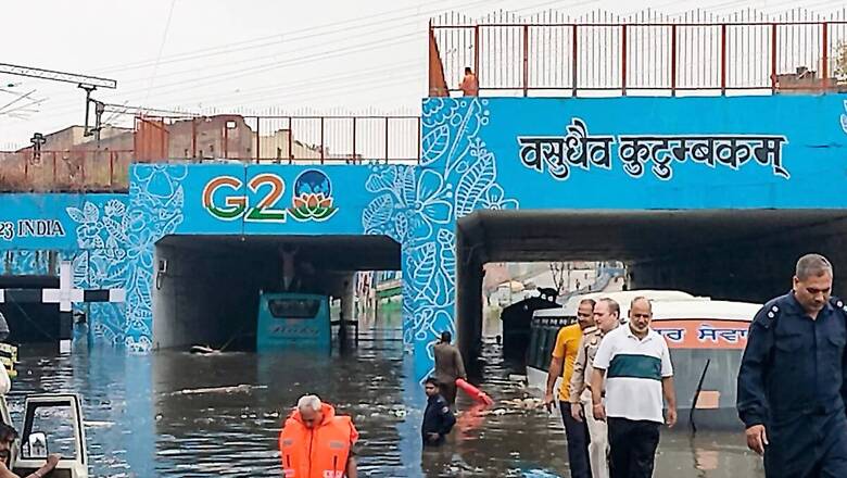
The disastrous rain spell over Delhi in the wee hours of June 28 was akin to a cloudburst and such extreme events are difficult to predict globally, said the India Meteorological Department (IMD) Chief Dr M Mohapatra. Nearly 228.1 mm rainfall fell over the national capital overnight wreaking havoc across the city.
While it is normal to expect heavy rain days in June, the possibility of extremely-heavy rainfall (more than 204.4 mm) during the month in Delhi is rare. The 228.1 mm rainfall recorded by the Safdarjung observatory is the highest daily-rainfall in June since 1936, and most of it fell in just two hours from 4 am to 6 am leading to a deluge. “It was not a cloudburst, but it was very close to one. Such types of rainfall activity confined over a small area and lasting for a shorter duration are certainly a challenge to predict, not just in India, but globally,” said the Director-General of Meteorology on Monday.
The IMD’s data shows that nearly 148.5 mm of the total 228.1 mm rain recorded at Safdarjung and 75.4 mm at Palam fell between 2:30 am and 5:30 am. But the activity became more intense from 5 am to 6 am when Delhi University station recorded a staggering 91 mm rain in just one hour, and Lodhi Road recorded 89 mm. “We have come a long way. But there are certain situations where it becomes just impossible (to predict). We would not have seen such impact had it been in a rural area. But we have to be cautious,” he added.
WHAT LED TO RECORD-BREAKING RAIN OVER DELHI?
An unstable atmosphere, and the distant effect of a low pressure system in Bay of Bengal intensified the small-scale rainfall and thunderstorm activity over Delhi-NCR (10-100 kms). The southwest monsoon which was stagnant since June 12 had become very active around June 25, and was heading towards North India. Its western arm towards the Arabian Sea became much stronger. Around the same time, a low pressure system formed over the Bay of Bengal near to the north Odisha-Gangetic West Bengal which led to strong flow of the warm and moist air towards Delhi.
“We analysed that Delhi’s rainfall event was dominated by south-easterly winds from the system formed in the Bay of Bengal. It was further strengthened by impact of a cyclonic circulation over Northwest Madhya Pradesh, an anticyclone, and a feeble western disturbance, all of which led to convergence of warm, moist air over the capital and made the convective activity intense,” said Mohapatra. Scientists also highlight that forecasts for heavy rainfall cover a larger area and tend to become uncertain as the geographical area reduces. Therefore, events like cloudbursts are harder to forecast as they are confined over a very small area.
THREE MORE RADARS, URBAN FLOOD WARNING SYSTEM FOR DELHI
Global warming is set to intensify such bursts of heavy rainfall, as a warmer atmosphere can hold more moisture for a long time. So, the IMD has also decided to ramp up its observational network to improve its forecasting skills further. It is now planning to put an Urban Flood Warning system in place for Delhi.
“It is a challenge to predict such events but we have to improve our observational network. We are working on an urban forecasting model specifically, and it will help us to improve our forecasts in future. There are three radars in Delhi, and we are working with the Ministry of Earth Sciences to establish three more in Delhi-NCR. We will also improve our existing Automatic Weather Stations (AWS) and rain gauges and establish an urban flood warning system just like Kolkata, Mumbai and Chennai,” said Mohapatra.
The weather department is also working to increase the lead time of its nowcast warnings for heavy rain and thunderstorms from 1.5 hours to at least three hours in near-future.


Comments
0 comment