
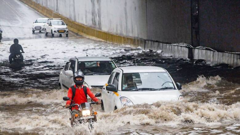
Most Indian states are likely to receive heavy to very heavy rainfall for the span of next two to three days with a cyclonic circulation over interior Odisha and adjoining Chhattisgarh, as per the latest weather bulletin of the Indian Meteorological Department. However, states may not experience a significant change on temperature during the same period, the IMD said.
“The monsoon trough at mean sea level runs south of its normal position. It is likely to persist in the same location during the next 2-3 days. A cyclonic circulation lies over interior Odisha & adjoining Chhattisgarh in lower & middle tropospheric levels,” the weather department’s bulletin read.
Eastern and Northeastern India
While the intensity of rainfall is likely to reduce over Odisha, Jharkhand and Andaman and Nicobar Islands on Monday from that of Sunday, heavy rainfall is predicted over West Bengal and Sikkim. Scattered to fairly widespread rainfall is likely over Bihar during the next five days.
Intermittent light rain was experienced in Kolkata and its suburbs throughout the day on Sunday, as the MeT Department forecast similar weather on Monday. The eastern metropolis received 10.1 mm of rainfall in 24 hours till 5.30 PM on Sunday, the MeT Department said.
The weatherman forecast cloudy sky with one or two spells of rain on Monday, as drizzles throughout the day on Sunday making the holiday enjoyable after days of hot and humid weather. The coastal areas in south Bengal and sub-Himalayan region in the north, however, experienced higher quantum of rainfall till 8.30 AM on Sunday.
Diamond Harbour in South 24 Parganas district received the highest rainfall in West Bengal at 66.5 mm during this period, while Haldia in Purba Medinipur district got 61 mm rain and the seaside resort town of Digha 16.7 mm, the MeT said. Kalimpong in the north received 50 mm of rainfall, while Cooch Behar got 29.9 mm and Darjeeling 15.2 mm, it said.
The MeT forecast heavy rainfall in Purba and Paschim Medinipur till Monday while the other south Bengal districts are likely to experience thunderstorms with lightning at one or two places. The weatherman forecast heavy rainfall till Monday in the sub-Himalayan districts of Darjeeling, Kalimpong, Jalpaiguri, Cooch Behar and Alipurduar.
Meanwhile, the seven sisters – Arunachal Pradesh, Assam, Meghalaya and Nagaland, Manipur, Mizoram and Tripura – will receive moderate to heavy rainfall.
Southern India
The Regional centre of the India Meteorological Department (IMD) has predicted heavy rainfall in Tamil Nadu till July 27.
Heavy rains are likely in Nilgiris, Coimbatore, Tiruppur, Theni, Dindigul, Erode, Krishnagiri, Dharmapuri, Tiruppatur, Salem, Kallakurichi, Karur, Namakkal, Tiruchirapalli, Perambalur, Madurai, Sivaganga, Virudhunagar, Ramanathapuram, Thoothukudi, Tirunelveli, Kanniyakumari and Thenkasi districts.
Chennai and adjoining areas are likely to have cloudy weather on Sunday, and light to moderate rainfall is likely in some areas.
The weather office also warned of thunderstorms and lightning in many parts of the state along with showers.
Telangana, especially districts along Godavari river, has been on alert since Saturday. Chief Minister K. Chandrasekhar Rao warned the officials that the state may face more intense floods than the one witnessed last week.
In view of the heavy rains and floods in several districts of the state since Friday, he reviewed the situation at a high-level meeting with ministers and officials.
KCR, as the Chief Minister is popularly known, noted that Godavari river is in spate from its originating point in Trimbakeshwar in Maharashtra to the point where it drains in the Bay of Bengal.
The overflowing rivulets, streams, lakes and tanks are also emptying into the river. Stating that this is a testing time for the state and people should be saved, he directed officials of all the departments not to leave their headquarters.
Western and Central India
A 40-meter patch of a newly constructed bridge on national highway connecting Madhya Pradesh capital city Bhopal to Nagpur and Jabalpur caves in at Mandeep near Bhopal following heavy rains and flood in Kaliasot river.
The IMD has predicted intense rainfall over the next two days for Gujarat, Rajasthan and Madhya Pradesh. The IMD on Sunday issued an orange alert warning of very heavy to extremely heavy rainfall in eight districts of central Madhya Pradesh. Some major rivers in the state are in spate due to intermittent rainfall over the last couple of days, prompting the authorities to open sluice gates of some vital dams. The IMD’s orange alert forecasts very heavy to extremely heavy rainfall, ranging from 115.6 mm or above, at isolated places in Bhopal, Raisen, Rajgarh, Sehore, Vidisha, Guna, Agar Malwa and Shajapur districts.
Apart from this, a yellow alert has been issued warning of likely heavy to very heavy rainfall at isolated places of 10 districts, and Shahdol and Narmadapuram divisions. The IMD has also issued a yellow alert warning of likely thunderstorms with lightning at isolated places of seven divisions – Bhopal, Jabalpur, Narmadapuram, Gwalior, Chambal, Rewa and Sagar.
All three alerts are valid till Monday morning, the IMD said. The state’s lifeline, Narmada river, besides Parvati, Betwa and some other water bodies were in spate, but flowing below the danger level, said Kamlesh Raikwar, an executive engineer of the state water resources department.
Meanwhile, monsoon is active in Rajasthan with heavy to very heavy rainfall recorded at many places in the last 24 hours, the meteorological department said here on Sunday. The highest rainfall during this period was recorded 176mm at Dheel Dam of Sawai Madhopur. According to the Meteorological Centre Jaipur, in the last 24 hours till Sunday morning, 110 mm rain was recorded in Jaitaran of Pali, 90 mm in Srinagar of Ajmer, 80 mm each in Bhim of Rajsamand and Bundi’s Hindoli, 70mm each in Bhungra of Banswara and in Peepalkhunt of Pratapgarh.
Light to moderate rain was recorded in all the districts of the state including Sikar, Chittorgarh, Jaipur, Bharatpur, Karauli, Jodhpur, Nagaur, Churu and Jaisalmer. There is a strong possibility of rain activities and active monsoon in most parts of the state for the next three-four days, the MeT said.
North India
Rainfall may intensify from July 27-28 in the national Capital, as predicted by the IMD, as Delhi saw light showers on Sunday.
Parts of the national capital witnessed rains on Sunday as the maximum temperature settled at 35.7 degrees Celsius, the meteorological department said. The minimum temperature was 27.1 degrees Celsius, it said.
Paschim Vihar in the western parts of the city and Laxmi Nagar in the east recorded rains. Shahdara and a few other places witnessed a drizzle, it added. The relative humidity oscillated between 89 per cent to 61 per cent.
According to the India Meteorological Department, the city will witness a generally cloudy sky with the possibility of thundershowers on Monday. The maximum and minimum temperatures are likely to hover around 36 degrees Celsius and 25 degrees Celsius respectively. On Saturday, the minimum temperature in Delhi settled at 25.5 degrees Celsius, two notches below the average, while the maximum temperature was 34.9 degrees Celsius.
At the same time, heavy showers is likely in Uttar Pradesh on July 27-28 and fairly widespread rainfall over Punjab and Haryana-Chandigarh on July 26.
In Jammu and Kashmir, isolated heavy rainfall accompanied by thunderstorm/lightning is likely and Himachal Pradesh and Uttarakhand between July 24 to 28.
Read all the Latest News and Breaking News here


Comments
0 comment