
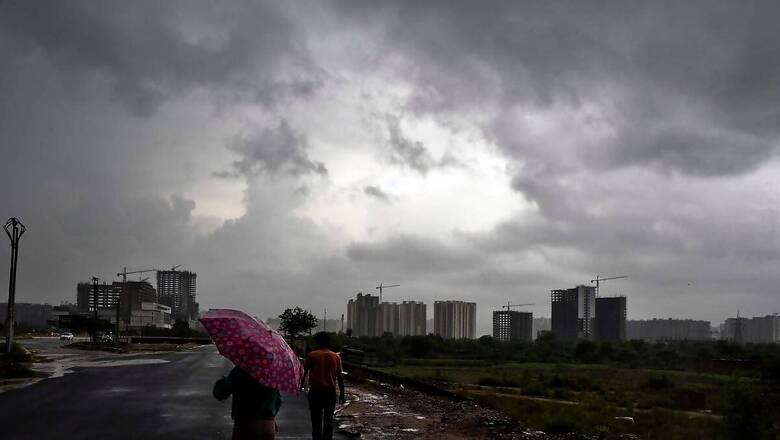
With a trough at mean sea level running off Maharashtra and Kerala coasts, the states are likely to get moderate to heavy rain over the next five days, according to the India Meteorological Department’s (IMD) weather forecast.
On Sunday, the Southwest Monsoon advanced into some more parts of Arabian Sea, Gujarat; remaining parts of Maharashtra; some more parts of Madhya Pradesh and Chhattisgarh; remaining parts of Odisha and some parts of Jharkhand.
Conditions are favourable for further advance of Southwest Monsoon into some more parts of North Arabian Sea and Gujarat State; some more parts of Madhya Pradesh; remaining parts of Chhattisgarh, West Bengal, Jharkhand and Bihar; some parts of Uttar Pradesh and Uttarakhand during next 3-4 days, said the IMD report.
A cyclonic circulation lies over south Chhattisgarh in lower and middle tropospheric levels and a trough runs from this cyclonic circulation to south Maharashtra in lower levels. Under their influence, fairly widespread light to moderate rainfall accompanied with thunderstorm, lightning and gusty winds (40-50 kmph) is likely over Konkan and Goa, central Maharashtra and Marathwada, Karnataka, Kerala and Mahe, Lakshadweep, Gujarat state; scattered to fairly widespread light to moderate rainfall over Coastal Andhra Pradesh and Yanam, Rayalaseema, Telangana, Tamil Nadu, Puducherry and Karaikal during the next five days.
IMD ON WEATHER SYSTEMS, FORECAST, WARNINGS
Isolated heavy to very heavy rainfall is very likely over Konkan and Goa, Ghat areas of Central Maharashtra, Karnataka during the next five days; over Gujarat Region on June 23, 24; over ghat areas of Tamil Nadu on June 23; Kerala and Mahe during June 23-25 and isolated heavy rainfall over Marathwada on June 23, Saurashtra and Kutch, Lakshadweep on June 23-24; Gujarat Region on June 25; Tamil Nadu on June 24, 25; Kerala and Mahe on June 26, 27 and over Coastal Andhra Pradesh and Yanam during June 25-27.
Isolated extremely heavy rainfall is also likely over Coastal and South Interior Karnataka, Kerala and Mahe on June 23.
Fairly widespread to widespread rainfall with thunderstorm, lightning and gusty winds (40-50 kmph) is very likely over Madhya Pradesh, Vidarbha, Chhattisgarh during next 5 days.
Isolated heavy rainfall is very likely over West Madhya Pradesh on June 23, 24 and 27; East Madhya Pradesh, Chhattisgarh on June 23, 26 and 27 and Vidarbha on June 23, 27.
Strong southerly/southwesterly winds prevail in the lower tropospheric levels from the Bay of Bengal into east and northeast India. In the lower tropospheric levels, a cyclonic circulation lies over central Rajasthan and a trough runs from this cyclonic circulation to south Chhattisgarh.
Under influence of these systems:
Fairly widespread light to moderate rainfall accompanied with thunderstorm, lightning and gusty winds (30-40 kmph) are very likely over Sub-Himalayan West Bengal and Sikkim on June 23, 24; Gangetic West Bengal, Uttar Pradesh during June 25-27; Bihar, Jharkhand, Odisha during the next five days.
Isolated heavy to very heavy rainfall very likely over Andaman and Nicobar Islands on June 24, 25; Sub-Himalayan West Bengal and Sikkim during June 25-27 and isolated heavy rainfall over Uttarakhand, East Uttar Pradesh, Bihar, Jharkhand during June 25-27; West Uttar Pradesh, East Rajasthan, Odisha on June 26, 27; Assam and Meghalaya, Nagaland, Manipur, Mizoram and Tripura during June 23-25 and Arunachal Pradesh on June 24 and 26.
Maximum temperature forecast for the next five days:
Rise in maximum temperature by about two degrees is very likely over the most parts of West Uttar Pradesh, Haryana, Chandigarh, Delhi and Punjab during next three days and no significant change thereafter. Fall in maximum temperature by 2-3°C very likely over most parts of central India during next 24 hours and no significant change thereafter. Heat wave conditions are very likely in isolated pockets of Punjab, Haryana, West Uttar Pradesh on June 24, 25 and abate thereafter.
IN THE PAST 24 HOURS
Maximum temperatures were in the range of 40-41°C over some parts of Haryana, West Rajasthan and Gujarat state and in the range of 38-40°C over many parts of Punjab, north Madhya Pradesh and over some parts of East Rajasthan, south Uttar Pradesh and West Jharkhand. The highest maximum temperature of 43.8°C was reported at Kanpur IAF (East Uttar Pradesh) over the country.
Heavy to very heavy rainfall were reported at isolated places over Telangana, Assam and Meghalaya, Nagaland, Manipur, Mizoram and Tripura; heavy rainfall at isolated places over Kerala and Mahe, Gujarat Region, Chhattisgarh, West Bengal and Sikkim.


Comments
0 comment